







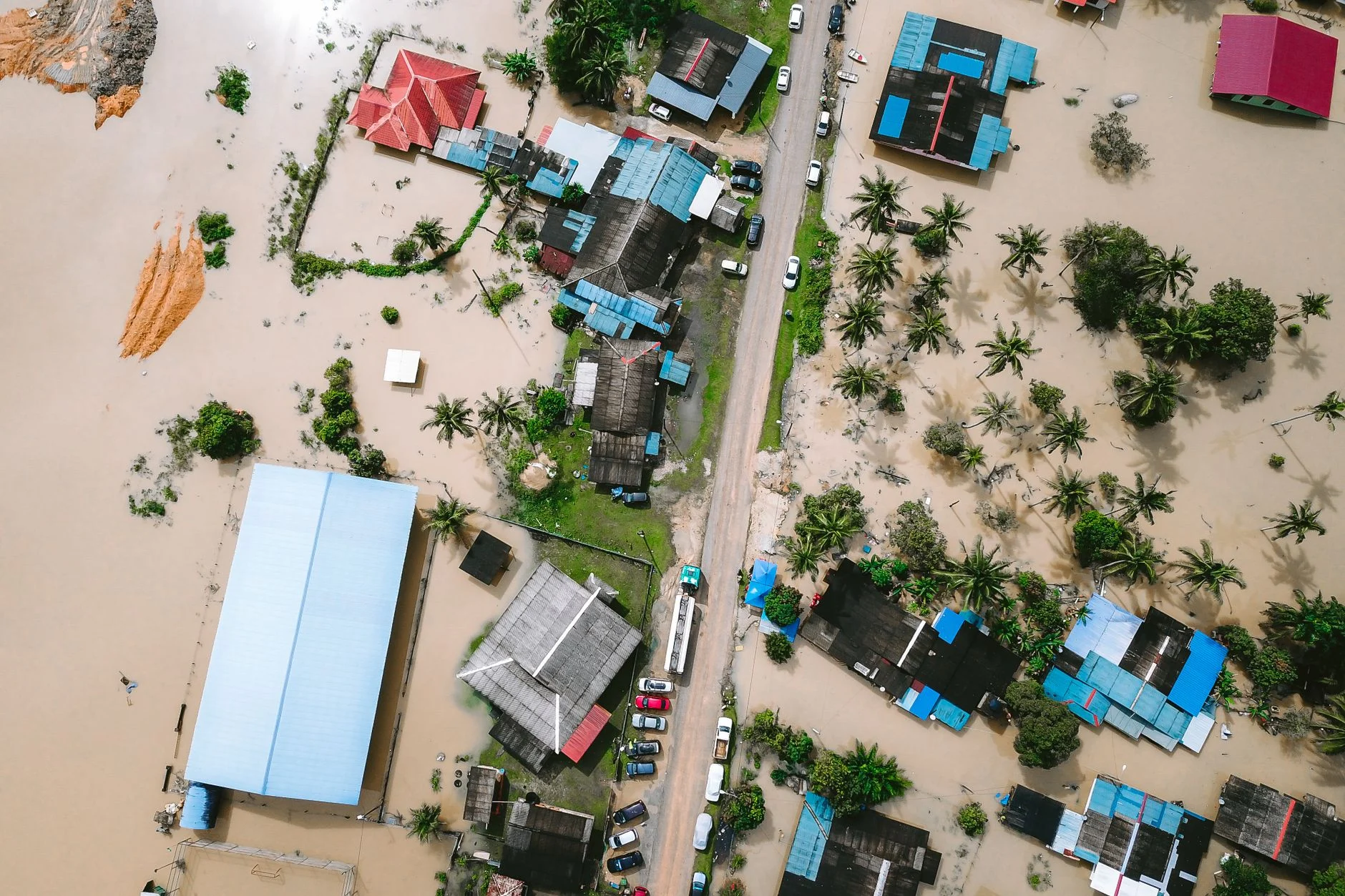
- Satellite imagery provided critical real-time data on flood-affected areas in Nepal.
- Remote sensing has enhanced coordination among government agencies and humanitarian organizations.
- Challenges remain in integrating satellite data with ground-level response infrastructure.
- The Nepal floods highlight the growing role of geospatial technology in disaster risk management globally.
What happened
In recent months, Nepal has experienced severe flooding caused by intense monsoon rains, affecting thousands of residents and overwhelming local emergency services. Satellite imagery played a pivotal role in mapping the extent of the flooding, identifying isolated communities, and assessing damage to infrastructure such as roads and bridges. This data was rapidly disseminated to government agencies and international aid groups, enabling a more targeted and timely response in areas that were otherwise difficult to access due to landslides and damaged communication networks.
Why it matters
The deployment of satellite technology during the Nepal floods marks a significant evolution in disaster response capabilities, especially in regions prone to natural calamities but with limited ground-based monitoring. Rapid, high-resolution imagery allows responders to prioritize resource allocation and evacuations with greater precision. This reduces the lag between disaster onset and humanitarian intervention, potentially saving lives and minimizing economic losses. Moreover, the Nepal case underscores how satellite data can bridge information gaps where traditional surveillance and reporting mechanisms falter.
Industry context
The use of satellite imagery in disaster response is part of a broader trend toward integrating geospatial intelligence in emergency management. Agencies such as NASA, the European Space Agency, and private satellite operators have expanded their data-sharing initiatives with governments and NGOs. However, the challenge lies not only in data acquisition but also in analysis, interpretation, and actionable dissemination. Nepal’s disaster response framework reflects ongoing efforts to institutionalize these technologies, albeit within constraints posed by infrastructure deficits, limited technical expertise, and funding gaps common in many developing countries.
Analysis
Nepal’s experience reveals a complex interplay between technology and on-the-ground realities. Satellite data provides a comprehensive macro-level perspective, yet its utility depends heavily on the capacity of local institutions to process and operationalize this information swiftly. The data’s value is maximized when combined with ground truthing and community engagement, ensuring that the insights translate into effective emergency planning and execution. Furthermore, the seasonal nature of flooding demands sustained investment in satellite monitoring systems and training, rather than ad hoc deployment during crises. Nepal’s incremental progress in embedding satellite technology into disaster protocols reflects a pragmatic approach to building resilience amid financial and logistical constraints.
What to watch next
Looking forward, the integration of satellite imagery with emerging technologies such as machine learning for predictive analytics, and the expansion of mobile connectivity in remote regions, will be critical in refining disaster response in Nepal and similar geographies. Monitoring how Nepal’s government and humanitarian partners address data interoperability challenges, capacity building, and infrastructure enhancement will provide key indicators of their ability to leverage geospatial intelligence effectively. Additionally, the evolution of international collaboration frameworks around satellite data sharing could set precedents influencing disaster management practices worldwide.
Ask AI about this story
Answers are based on this article and SN Media’s related coverage. AI can make mistakes.
Frequently asked questions
How did satellite imagery specifically aid disaster response during the Nepal floods?
Satellite imagery mapped flood extent, identified isolated communities, and assessed infrastructure damage, enabling targeted and timely responses in areas difficult to access due to landslides and damaged communications.
What challenges remain in using satellite data for disaster management in Nepal?
Challenges include integrating satellite data with ground-level response systems, limited technical expertise, infrastructure deficits, and funding gaps that affect data analysis, interpretation, and actionable dissemination.
Why is the Nepal flood response significant for the broader use of satellite technology in emergencies?
Nepalu2019s case highlights how satellite data can fill information gaps where traditional monitoring fails, improving resource prioritization and reducing response delays, thus marking an evolution in disaster response capabilities especially in regions with limited ground monitoring.
What future developments are expected to enhance the use of satellite imagery in Nepalu2019s disaster management?
Future improvements include integrating satellite imagery with machine learning for predictive analytics, expanding mobile connectivity in remote areas, addressing data interoperability, capacity building, and enhancing infrastructure to better leverage geospatial intelligence.
Continue the story
 LATEST
Urban Infrastructure Challenges Exposed by Flash Flooding in Tri-State Area
LATEST
Urban Infrastructure Challenges Exposed by Flash Flooding in Tri-State Area
- LATEST UK’s New Space Defense Unit: A Game Changer in Satellite Security
- LATEST Power Grid Vulnerabilities Exposed by Hurricane Isaias in the Gulf Coast
- LATEST Economic Impact of the Nor’easter on East Coast Businesses and Infrastructure
- LATEST Global Health Security and the Risk of Plague Resurgence in Siberia