







August 27, 2026
Nepal-Tibet flash floods live: Verified footage, maps, and satellite data reveal causes
A glacier-and-bedrock collapse appears to have set off a cascading flood across the Nepal–Tibet border. The disaster is still unfolding, and investigators are separating what satellite evidence shows from what remains unknown.
What we know
- Nepal Police confirmed 469 deaths in Nepal and over 1,500 people missing across Nepal and Tibet as of 28 August amid ongoing search and rescue efforts.
- Preliminary scientific assessments indicate the disaster was caused by a collapse of bedrock and glacier ice near the Nepal–Tibet border, temporarily blocking a river and triggering a fast, destructive outburst flood downstream.
- An upstream lake formed by debris from the collapse is currently overflowing, posing renewed flood risks to rescue teams and nearby communities.
- UNICEF reports more than 17,000 children require urgent humanitarian assistance following the floods, while Nepal’s government continues emergency relief and damage assessments in affected districts.
- Rescue and relief operations face challenges from damaged infrastructure, unstable terrain, and weather conditions; authorities emphasize the investigation into the exact cause remains preliminary.
Live updates
Publication times are shown in US Eastern Time and UTC. Event times are stated in the update text when confirmed.
More current footage: mudslide and flooding at Gyirong Port
Watch additional footage from Gyirong Port on Wikimedia Commons. We link to the original file rather than copy it because the source video’s licensing and provenance need to remain visible to viewers.
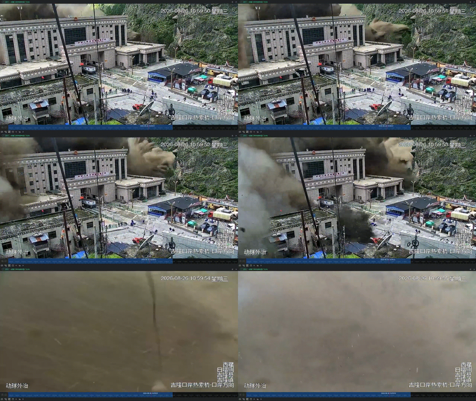
Current camera footage: the flood surge at Gyirong Port
Current automated-camera footage from Gyirong Port, recorded on 26 August as the surge arrived. The clip is included as visual evidence of the flood’s speed; it does not by itself establish the cause.
Satellite video: before-and-after view of the flood area
Watch the public-domain satellite before-and-after video. The composite uses Copernicus Sentinel-2 and Landsat imagery, uploaded on 27 August. It visualizes landscape change and should be read alongside ground reporting.
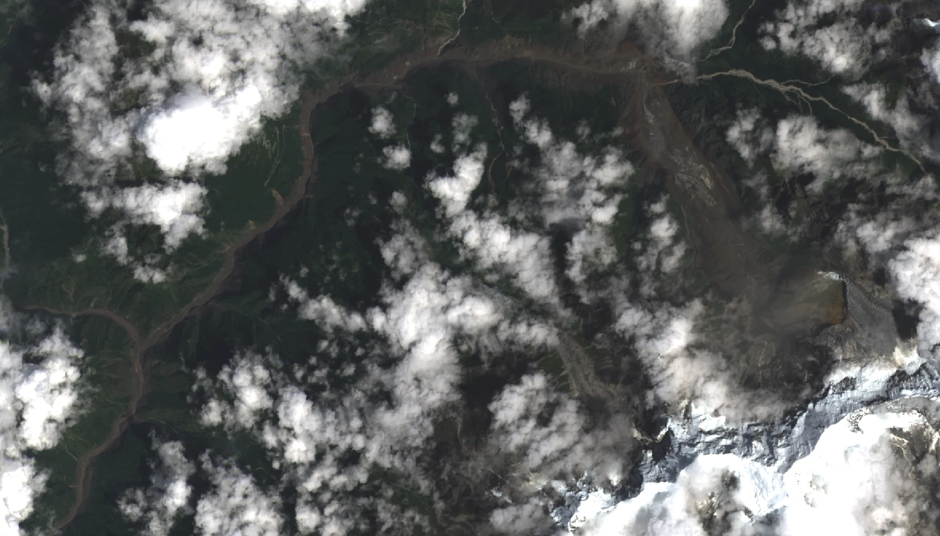
Current satellite image: flood aftermath along the border
Current Landsat 9 satellite image, captured on 26 August after the flood. It identifies the scar of the landslide and the affected river corridor near the Nepal–Tibet border. It is a satellite view, not a casualty or damage assessment.
Humanitarian response: children need urgent assistance
UNICEF says more than 17,000 children need urgent humanitarian assistance following the floods. Nepal’s government says search, rescue and emergency relief operations began immediately and that damage assessments are ongoing in Rasuwa, Nuwakot, Dhading and Gorkha districts.
What happened: a cascading ice, rock and water surge
Scientists stress that the investigation is preliminary. Their current reconstruction is that a large section of bedrock and glacier ice collapsed from the Langtang Lirung area near the Nepal–Tibet border. The avalanche appears to have temporarily blocked the river; backed-up water, melting ice, boulders and sediment then surged through the steep valley. That combination explains why the flood was fast, muddy and exceptionally destructive downstream. A direct causal link to climate change has not been established for this specific collapse, though scientists say warming increases the conditions that can make high-mountain hazards more likely.
Latest: rescue teams face a renewed flood threat
Rescue teams are continuing searches through mud and debris. The latest figure reported by Nepal Police to AP was 469 deaths in Nepal; China had not updated its reported three deaths in Tibet, while authorities in both countries said more than 1,500 people were missing. These numbers can change as searches continue. Authorities also warned that the upstream lake formed after the disaster was overflowing, creating a renewed flood risk for responders and nearby communities.
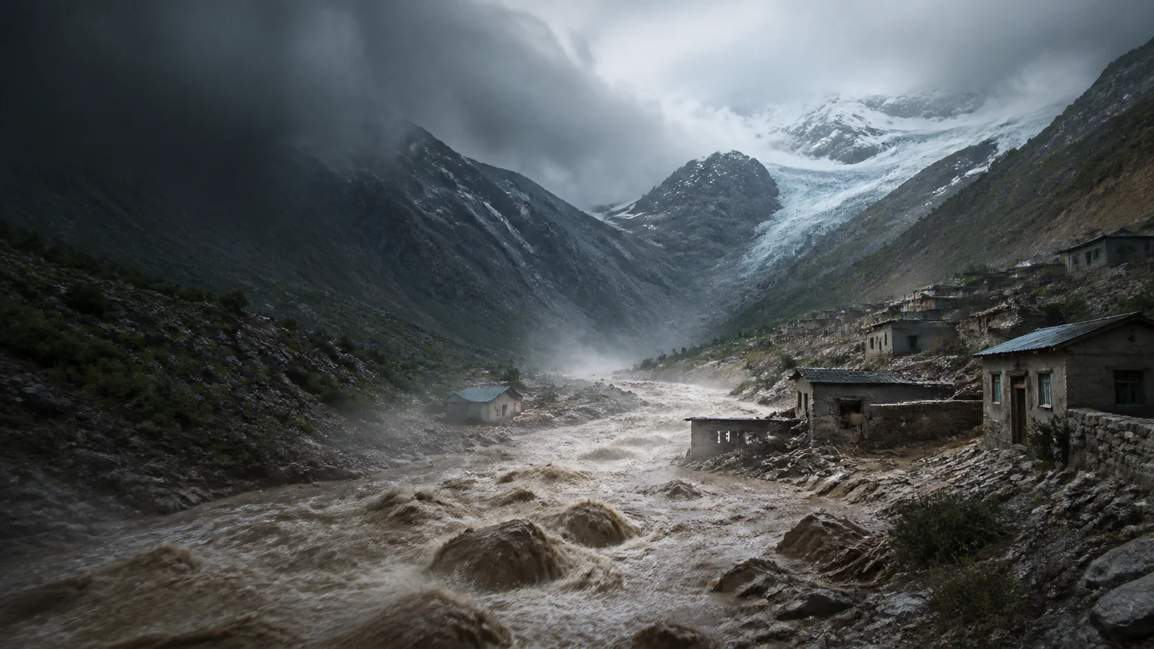
Visual context: Himalayan flood setting
Original AI editorial illustration used for this live story. It depicts the Himalayan flood setting and is not documentary photography or evidence from the disaster site.
Verified visual reporting: footage, maps and satellite comparisons
Video filmed by the Nepal Red Cross and published by Euronews shows floodwaters moving through the Rasuwa valley. Watch the video on Euronews.
For before-and-after satellite comparisons and a visual reconstruction of the disaster area, see ABC News Verify’s satellite analysis. SN Media is linking to these reports rather than republishing licensed agency footage or photographs without permission.
What investigators think happened — and what is still unknown
Satellite imagery reviewed by scientists points to a collapse involving bedrock and glacier ice near the border. The working explanation is that debris temporarily blocked water before a destructive surge moved downstream.
This remains a preliminary scientific assessment, not a final official conclusion. The exact sequence, the volume of water involved and the role of weather or other triggers are still being examined.
New toll and upstream-lake warning deepen the emergency
Associated Press reported on 28 August that at least 469 people had been confirmed dead in Nepal and more than 1,500 people were missing across Nepal and Tibet. The figures are a later media tally and should not be directly combined with earlier government updates, which may use different reporting cut-offs and definitions.
AP also reported that authorities were monitoring a newly formed, overflowing lake upstream, warning that it could trigger further flooding. Rescue operations remain constrained by damaged roads, unstable terrain and weather.
Rescue operations continue as officials warn the toll may change
Nepal’s Foreign Ministry says the 26 August flash flood in the Bhote Koshi River area caused widespread damage to homes, roads, bridges, hydropower facilities and other critical infrastructure. In its 27 August update, the ministry said 359 bodies had been recovered and 596 people from 33 countries were still reported missing. Those figures may change as search and rescue operations continue.
The cause is still under investigation. Preliminary assessments cited by scientists who reviewed satellite imagery indicate that a collapse involving glacier ice and bedrock near the Nepal–Tibet border may have temporarily blocked a river before water and debris surged downstream. That assessment is preliminary; it is not yet a final official finding on the mechanism of the flood.
Authorities say rescue, evacuation, medical assistance and relief operations are underway, while river systems and downstream flood risks continue to be monitored. Nepal’s Foreign Ministry has asked people seeking information about affected foreign nationals to use official channels and avoid circulating unverified claims.
What we’ll be tracking
Why it matters
More than 17,000 children need urgent assistance and hundreds of people are confirmed dead or missing, highlighting the severe human toll of the floods.
A cascading surge of ice, rock, and water from a glacier and bedrock collapse caused a fast, muddy, and destructive flood downstream.
An upstream lake formed by the disaster is overflowing, posing renewed flood threats to rescue teams and nearby communities.
Background
A flood that began high in the Himalayas
On 26 August, a sudden surge of water, mud, ice and rock swept through valleys straddling the Nepal–Tibet border. It damaged settlements, roads, bridges and hydropower infrastructure along the Bhote Koshi–Trishuli river corridor. The scale of loss became clearer only after the first hours: access routes were damaged, terrain was unstable and the affected area lay in steep mountain valleys where a fast-moving debris flow can cut communities off in minutes.
This is a developing disaster, so the numbers must be read as time-stamped snapshots rather than final totals. On 28 August, Nepal Police told the Associated Press that 469 people had died in Nepal. Chinese authorities had previously reported three deaths in Tibet, and authorities across the border area said more than 1,500 people were missing. Search teams were still working through mud and debris, so authorities cautioned that both the death toll and the missing-person count could change.
What caused it?
The short answer is that investigators are still reconstructing the sequence. The leading preliminary explanation is not simply “heavy rain.” Scientists studying satellite imagery say a large mass of bedrock collapsed near Langtang Lirung and carried glacier ice with it into the valley. The debris appears to have temporarily obstructed the river. Water then accumulated behind that blockage before breaking through or overtopping it, turning the release into a high-energy surge packed with sediment, boulders and ice.
That sequence matters. A normal river flood rises as water accumulates. An outburst flood can arrive as a sudden pulse, particularly when a temporary natural dam fails in a narrow, steep valley. The flow can scour banks, widen channels, carry debris into bridges and settlements and keep moving downstream long after the initial collapse. Satellite images showed the river corridor changed markedly after the event, with water turning sediment-laden and spreading beyond its previous channel in places.
There are important limits to what can responsibly be said now. The collapse mechanism, the amount of water stored behind the debris and the contribution of weather, seismic activity or pre-existing ice conditions remain under investigation. Scientists have also said it is too early to attribute this individual collapse directly to climate change. What is clearer is the broader risk context: warming, thawing permafrost, changing glacier geometry and unstable high-mountain slopes can make this class of hazard more likely in the Himalayas. That is context, not a final verdict on this event.
Why the impact was so severe
Topography amplified the hazard. The source area sits above narrow valleys that concentrate water and debris rather than allowing them to spread slowly across a broad floodplain. Once the surge entered downstream corridors, it reached roads, border facilities, homes, markets and energy infrastructure. Damage to transport links then created a second emergency: the same roads needed for evacuation, medical support and heavy equipment were among the assets most vulnerable to the flood.
The disaster also crossed administrative and national boundaries. The rivers and valleys do not stop at the border, while warning, rescue and information systems are managed by different agencies. Nepal’s government says the impact extends across Rasuwa, Nuwakot, Dhading and Gorkha districts. The humanitarian task therefore includes rescuing people, mapping changing hazards, restoring communications and helping families identify or locate relatives.
The immediate danger is not over
Rescue operations are taking place under the threat of additional flooding. AP reported that a lake formed upstream after the collapse was overflowing, and Nepal Police warned personnel and people in exposed areas to stay ready to move to safety. This does not mean a second disaster is inevitable. It does mean the downstream risk picture can change quickly while water, sediment and debris continue to rearrange the valley.
For residents and responders, the practical implications are straightforward: avoid damaged riverbanks and bridges, follow local evacuation instructions, treat early reports and social-media videos with care, and rely on official notices for travel or relief information. Visual material can show the violence of the surge, but it cannot by itself establish the origin, time or future hazard of every clip. SN Media labels its current visual updates accordingly and links to their original sources.
Humanitarian needs
UNICEF says more than 17,000 children need urgent humanitarian assistance after the floods. Needs include safe water, health services, protection, shelter, education continuity and family tracing. Nepal’s government has said assessment work is continuing alongside search, rescue and emergency relief. The first priority is saving lives; the next is restoring safe access to communities and making sure assistance reaches people who have been cut off by damaged infrastructure.
What to watch next
The key questions are whether the upstream lake stabilizes, how many missing people can be located and identified, which routes reopen, and what a joint scientific assessment concludes about the collapse. The disaster will also test the region’s ability to convert satellite monitoring and local warnings into fast action in high, remote valleys. This page will distinguish confirmed updates from preliminary analysis as the record develops.